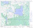
Maps showing Kehewin Cree Nation, 21-59-6-W4, Alberta
Kehewin Cree Nation is a Unincorporated area located in 21-59-6-W4, Alberta.
- Latitude: 54° 5' 1'' North (decimal: 54.0836109)
- Longitude: 110° 49' 58'' West (decimal: -110.8327778)
- Topography Feature Category: Unincorporated area
- Geographical Feature: Locality
- Canadian Province/Territory: Alberta
- Location: 21-59-6-W4
- Atlas of Canada Locator Map: Kehewin Cree Nation
- GPS Coordinate Locator Map: Kehewin Cree Nation Lat/Long
Kehewin Cree Nation NTS Map Sheets