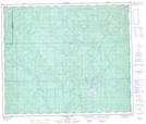
Maps showing Grizzly Creek, 18-62-13-W5, Alberta
Grizzly Creek is a River located in 18-62-13-W5, Alberta.
- Latitude: 54° 21' 36'' North (decimal: 54.3599999)
- Longitude: 115° 55' 40'' West (decimal: -115.9277778)
- Topography Feature Category: River
- Geographical Feature: Creek
- Canadian Province/Territory: Alberta
- Location: 18-62-13-W5
- Atlas of Canada Locator Map: Grizzly Creek
- GPS Coordinate Locator Map: Grizzly Creek Lat/Long
Grizzly Creek NTS Map Sheets