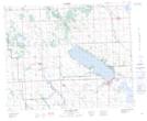
Maps showing Durham Creek, 25-39-1-W5, Alberta
Durham Creek is a River located in 25-39-1-W5, Alberta.
- Latitude: 52° 23' 18'' North (decimal: 52.3883333)
- Longitude: 114° 1' 24'' West (decimal: -114.0233333)
- Topography Feature Category: River
- Geographical Feature: Creek
- Canadian Province/Territory: Alberta
- Location: 25-39-1-W5
- Atlas of Canada Locator Map: Durham Creek
- GPS Coordinate Locator Map: Durham Creek Lat/Long
Durham Creek NTS Map Sheets