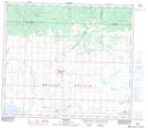
Maps showing Dinosaur Hill, 26-72-4-W6, Alberta
Dinosaur Hill is a Mountain located in 26-72-4-W6, Alberta.
- Latitude: 55° 15' 34'' North (decimal: 55.2594444)
- Longitude: 118° 30' 35'' West (decimal: -118.5097221)
- Topography Feature Category: Mountain
- Geographical Feature: Hill
- Canadian Province/Territory: Alberta
- Location: 26-72-4-W6
- Atlas of Canada Locator Map: Dinosaur Hill
- GPS Coordinate Locator Map: Dinosaur Hill Lat/Long
Dinosaur Hill NTS Map Sheets