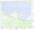
Maps showing Jim Cook's Creek, 17-73-11-W5, Alberta
Jim Cook's Creek is a River located in 17-73-11-W5, Alberta.
- Latitude: 55° 19' 20'' North (decimal: 55.3222221)
- Longitude: 115° 39' 3'' West (decimal: -115.6508333)
- Topography Feature Category: River
- Geographical Feature: Creek
- Canadian Province/Territory: Alberta
- Location: 17-73-11-W5
- Atlas of Canada Locator Map: Jim Cook's Creek
- GPS Coordinate Locator Map: Jim Cook's Creek Lat/Long
Jim Cook's Creek NTS Map Sheets