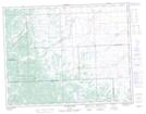
Maps showing Eden Valley 216, 11,18,4, Alberta
Eden Valley 216 is a Indian Reserve located in 11,18,4, Alberta.
- Latitude: 50° 28' 10'' North (decimal: 50.4695279)
- Longitude: 114° 14' 17'' West (decimal: -114.2379170)
- Topography Feature Category: Indian Reserve
- Geographical Feature: Indian Reserve - Réserve indienne
- Canadian Province/Territory: Alberta
- Location: 11,18,4
- Atlas of Canada Locator Map: Eden Valley 216
- GPS Coordinate Locator Map: Eden Valley 216 Lat/Long
Eden Valley 216 NTS Map Sheets