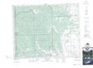
Maps showing Stoney 142B, 22,27,6, Alberta
Stoney 142B is a Indian Reserve located in 22,27,6, Alberta.
- Latitude: 51° 19' 41'' North (decimal: 51.3280555)
- Longitude: 114° 46' 13'' West (decimal: -114.7702778)
- Topography Feature Category: Indian Reserve
- Geographical Feature: Indian Reserve - Réserve indienne
- Canadian Province/Territory: Alberta
- Location: 22,27,6
- Atlas of Canada Locator Map: Stoney 142B
- GPS Coordinate Locator Map: Stoney 142B Lat/Long
Stoney 142B NTS Map Sheets