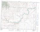
Maps showing Peigan Timber Limit B, 12,7,29, Alberta
Peigan Timber Limit B is a Indian Reserve located in 12,7,29, Alberta.
- Latitude: 49° 44' 50'' North (decimal: 49.7472222)
- Longitude: 113° 58' 20'' West (decimal: -113.9722222)
- Topography Feature Category: Indian Reserve
- Geographical Feature: Indian Reserve - Réserve indienne
- Canadian Province/Territory: Alberta
- Location: 12,7,29
- Atlas of Canada Locator Map: Peigan Timber Limit B
- GPS Coordinate Locator Map: Peigan Timber Limit B Lat/Long