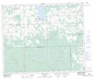
Maps showing Buck Lake 133C, 17-45-5-W5, Alberta
Buck Lake 133C is a Indian Reserve located in 17-45-5-W5, Alberta.
- Latitude: 52° 53' 13'' North (decimal: 52.8869444)
- Longitude: 114° 40' 43'' West (decimal: -114.6786110)
- Topography Feature Category: Indian Reserve
- Geographical Feature: Indian Reserve - Réserve indienne
- Canadian Province/Territory: Alberta
- Location: 17-45-5-W5
- Atlas of Canada Locator Map: Buck Lake 133C
- GPS Coordinate Locator Map: Buck Lake 133C Lat/Long
Buck Lake 133C NTS Map Sheets