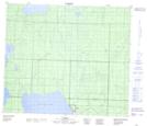
Maps showing Jean Baptiste Gambler 183, Alberta
Jean Baptiste Gambler 183 is a Indian Reserve located in Alberta.
- Latitude: 55° 15' 51'' North (decimal: 55.2641666)
- Longitude: 113° 13' 27'' West (decimal: -113.2241667)
- Topography Feature Category: Indian Reserve
- Geographical Feature: Indian Reserve - Réserve indienne
- Canadian Province/Territory: Alberta
- Atlas of Canada Locator Map: Jean Baptiste Gambler 183
- GPS Coordinate Locator Map: Jean Baptiste Gambler 183 Lat/Long
Jean Baptiste Gambler 183 NTS Map Sheets