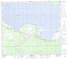
Maps showing Drift Pile River 150, 74-12-W5, Alberta
Drift Pile River 150 is a Indian Reserve located in 74-12-W5, Alberta.
- Latitude: 55° 21' 36'' North (decimal: 55.3600000)
- Longitude: 115° 46' 36'' West (decimal: -115.7766667)
- Topography Feature Category: Indian Reserve
- Geographical Feature: Indian Reserve - Réserve indienne
- Canadian Province/Territory: Alberta
- Location: 74-12-W5
- Atlas of Canada Locator Map: Drift Pile River 150
- GPS Coordinate Locator Map: Drift Pile River 150 Lat/Long
Drift Pile River 150 NTS Map Sheets