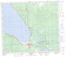
Maps showing Sawridge 150H, 73-6-W5, Alberta
Sawridge 150H is a Indian Reserve located in 73-6-W5, Alberta.
- Latitude: 55° 18' 42'' North (decimal: 55.3116666)
- Longitude: 114° 52' 6'' West (decimal: -114.8683332)
- Topography Feature Category: Indian Reserve
- Geographical Feature: Indian Reserve - Réserve indienne
- Canadian Province/Territory: Alberta
- Location: 73-6-W5
- Atlas of Canada Locator Map: Sawridge 150H
- GPS Coordinate Locator Map: Sawridge 150H Lat/Long
Sawridge 150H NTS Map Sheets