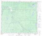
Maps showing Sturgeon Lake 154B, 69-24-W5, Alberta
Sturgeon Lake 154B is a Indian Reserve located in 69-24-W5, Alberta.
- Latitude: 54° 58' 51'' North (decimal: 54.9808333)
- Longitude: 117° 33' 43'' West (decimal: -117.5619444)
- Topography Feature Category: Indian Reserve
- Geographical Feature: Indian Reserve - Réserve indienne
- Canadian Province/Territory: Alberta
- Location: 69-24-W5
- Atlas of Canada Locator Map: Sturgeon Lake 154B
- GPS Coordinate Locator Map: Sturgeon Lake 154B Lat/Long
Sturgeon Lake 154B NTS Map Sheets