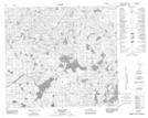
Maps showing Utikoomak Lake 155B, 23-81-11-W5, Alberta
Utikoomak Lake 155B is a Indian Reserve located in 23-81-11-W5, Alberta.
- Latitude: 56° 2' 21'' North (decimal: 56.0391666)
- Longitude: 115° 35' 57'' West (decimal: -115.5991666)
- Topography Feature Category: Indian Reserve
- Geographical Feature: Indian Reserve - Réserve indienne
- Canadian Province/Territory: Alberta
- Location: 23-81-11-W5
- Atlas of Canada Locator Map: Utikoomak Lake 155B
- GPS Coordinate Locator Map: Utikoomak Lake 155B Lat/Long
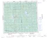
Utikoomak Lake 155B NTS Map Sheets