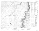
Maps showing House River Indian Cemetery 178, 18-83-16-W4, Alberta
House River Indian Cemetery 178 is a Indian Reserve located in 18-83-16-W4, Alberta.
- Latitude: 56° 12' 5'' North (decimal: 56.2013888)
- Longitude: 112° 30' 33'' West (decimal: -112.5091666)
- Topography Feature Category: Indian Reserve
- Geographical Feature: Indian Reserve - Réserve indienne
- Canadian Province/Territory: Alberta
- Location: 18-83-16-W4
- Atlas of Canada Locator Map: House River Indian Cemetery 178
- GPS Coordinate Locator Map: House River Indian Cemetery 178 Lat/Long
House River Indian Cemetery 178 NTS Map Sheets