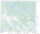
Maps showing Beaver Lake 131, 34-65-13-W4, Alberta
Beaver Lake 131 is a Indian Reserve located in 34-65-13-W4, Alberta.
- Latitude: 54° 40' 7'' North (decimal: 54.6686110)
- Longitude: 111° 52' 17'' West (decimal: -111.8713889)
- Topography Feature Category: Indian Reserve
- Geographical Feature: Indian Reserve - Réserve indienne
- Canadian Province/Territory: Alberta
- Location: 34-65-13-W4
- Atlas of Canada Locator Map: Beaver Lake 131
- GPS Coordinate Locator Map: Beaver Lake 131 Lat/Long
Beaver Lake 131 NTS Map Sheets