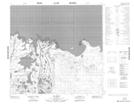
Maps showing Chipewyan 201A, 21-111-4-W4, Alberta
Chipewyan 201A is a Indian Reserve located in 21-111-4-W4, Alberta.
- Latitude: 58° 38' 47'' North (decimal: 58.6463889)
- Longitude: 110° 36' 31'' West (decimal: -110.6086111)
- Topography Feature Category: Indian Reserve
- Geographical Feature: Indian Reserve - Réserve indienne
- Canadian Province/Territory: Alberta
- Location: 21-111-4-W4
- Atlas of Canada Locator Map: Chipewyan 201A
- GPS Coordinate Locator Map: Chipewyan 201A Lat/Long
Chipewyan 201A NTS Map Sheets