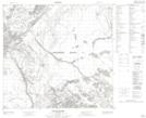
Maps showing Chipewyan 201D, 27-108-6-W4, Alberta
Chipewyan 201D is a Indian Reserve located in 27-108-6-W4, Alberta.
- Latitude: 58° 24' 47'' North (decimal: 58.4129720)
- Longitude: 110° 55' 8'' West (decimal: -110.9187779)
- Topography Feature Category: Indian Reserve
- Geographical Feature: Indian Reserve - Réserve indienne
- Canadian Province/Territory: Alberta
- Location: 27-108-6-W4
- Atlas of Canada Locator Map: Chipewyan 201D
- GPS Coordinate Locator Map: Chipewyan 201D Lat/Long
Chipewyan 201D NTS Map Sheets