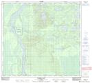
Maps showing Chipewyan 201G, 3-103-9-W4, Alberta
Chipewyan 201G is a Indian Reserve located in 3-103-9-W4, Alberta.
- Latitude: 57° 54' 16'' North (decimal: 57.9044444)
- Longitude: 111° 23' 51'' West (decimal: -111.3974999)
- Topography Feature Category: Indian Reserve
- Geographical Feature: Indian Reserve - Réserve indienne
- Canadian Province/Territory: Alberta
- Location: 3-103-9-W4
- Atlas of Canada Locator Map: Chipewyan 201G
- GPS Coordinate Locator Map: Chipewyan 201G Lat/Long
Chipewyan 201G NTS Map Sheets