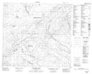
Maps showing Namur River 174A, 19-98-16-W4, Alberta
Namur River 174A is a Indian Reserve located in 19-98-16-W4, Alberta.
- Latitude: 57° 29' 15'' North (decimal: 57.4875000)
- Longitude: 112° 30' 3'' West (decimal: -112.5008332)
- Topography Feature Category: Indian Reserve
- Geographical Feature: Indian Reserve - Réserve indienne
- Canadian Province/Territory: Alberta
- Location: 19-98-16-W4
- Atlas of Canada Locator Map: Namur River 174A
- GPS Coordinate Locator Map: Namur River 174A Lat/Long
Namur River 174A NTS Map Sheets