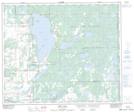
Maps showing Unipouheos 121, 56,57-2,3-W4, Alberta
Unipouheos 121 is a Indian Reserve located in 56,57-2,3-W4, Alberta.
- Latitude: 53° 52' North (decimal: 53.8666666)
- Longitude: 110° 21' West (decimal: -110.3499999)
- Topography Feature Category: Indian Reserve
- Geographical Feature: Indian Reserve - Réserve indienne
- Canadian Province/Territory: Alberta
- Location: 56,57-2,3-W4
- Atlas of Canada Locator Map: Unipouheos 121
- GPS Coordinate Locator Map: Unipouheos 121 Lat/Long
Unipouheos 121 NTS Map Sheets