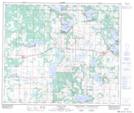
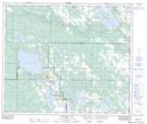
Maps showing WhiteFish Lake 128, 30-61-12-W4, Alberta
WhiteFish Lake 128 is a Indian Reserve located in 30-61-12-W4, Alberta.
- Latitude: 54° 19' 55'' North (decimal: 54.3319000)
- Longitude: 111° 47' 33'' West (decimal: -111.7925000)
- Topography Feature Category: Indian Reserve
- Geographical Feature: Indian Reserve - Réserve indienne
- Canadian Province/Territory: Alberta
- Location: 30-61-12-W4
- Atlas of Canada Locator Map: WhiteFish Lake 128
- GPS Coordinate Locator Map: WhiteFish Lake 128 Lat/Long
WhiteFish Lake 128 NTS Map Sheets