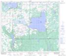
Maps showing Kehiwin 123, 16-59-6-W4, Alberta
Kehiwin 123 is a Indian Reserve located in 16-59-6-W4, Alberta.
- Latitude: 54° 6' 23'' North (decimal: 54.1063888)
- Longitude: 110° 50' 10'' West (decimal: -110.8361111)
- Topography Feature Category: Indian Reserve
- Geographical Feature: Indian Reserve - Réserve indienne
- Canadian Province/Territory: Alberta
- Location: 16-59-6-W4
- Atlas of Canada Locator Map: Kehiwin 123
- GPS Coordinate Locator Map: Kehiwin 123 Lat/Long
Kehiwin 123 NTS Map Sheets