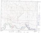
Maps showing Siksika 146, 14-21-22-W4, Alberta
Siksika 146 is a Indian Reserve located in 14-21-22-W4, Alberta.
- Latitude: 50° 46' 28'' North (decimal: 50.7744444)
- Longitude: 112° 54' 22'' West (decimal: -112.9061111)
- Topography Feature Category: Indian Reserve
- Geographical Feature: Indian Reserve - Réserve indienne
- Canadian Province/Territory: Alberta
- Location: 14-21-22-W4
- Atlas of Canada Locator Map: Siksika 146
- GPS Coordinate Locator Map: Siksika 146 Lat/Long