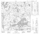
Maps showing Collin Lake 223, 12-122-1,2-W4, Alberta
Collin Lake 223 is a Indian Reserve located in 12-122-1,2-W4, Alberta.
- Latitude: 59° 35' 10'' North (decimal: 59.5861110)
- Longitude: 110° 10' 30'' West (decimal: -110.1749999)
- Topography Feature Category: Indian Reserve
- Geographical Feature: Indian Reserve - Réserve indienne
- Canadian Province/Territory: Alberta
- Location: 12-122-1,2-W4
- Atlas of Canada Locator Map: Collin Lake 223
- GPS Coordinate Locator Map: Collin Lake 223 Lat/Long
Collin Lake 223 NTS Map Sheets