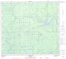
Maps showing Woodland Cree 226, 86,87-15,16,17-W5, Alberta
Woodland Cree 226 is a Indian Reserve located in 86,87-15,16,17-W5, Alberta.
- Latitude: 56° 29' 55'' North (decimal: 56.4986111)
- Longitude: 116° 30' 22'' West (decimal: -116.5061111)
- Topography Feature Category: Indian Reserve
- Geographical Feature: Indian Reserve - Réserve indienne
- Canadian Province/Territory: Alberta
- Location: 86,87-15,16,17-W5
- Atlas of Canada Locator Map: Woodland Cree 226
- GPS Coordinate Locator Map: Woodland Cree 226 Lat/Long
Woodland Cree 226 NTS Map Sheets