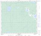
Maps showing Woodland Cree 228, 86,87-13,14-W5, Alberta
Woodland Cree 228 is a Indian Reserve located in 86,87-13,14-W5, Alberta.
- Latitude: 56° 28' 40'' North (decimal: 56.4777777)
- Longitude: 116° 5' 00'' West (decimal: -116.0833332)
- Topography Feature Category: Indian Reserve
- Geographical Feature: Indian Reserve - Réserve indienne
- Canadian Province/Territory: Alberta
- Location: 86,87-13,14-W5
- Atlas of Canada Locator Map: Woodland Cree 228
- GPS Coordinate Locator Map: Woodland Cree 228 Lat/Long
Woodland Cree 228 NTS Map Sheets