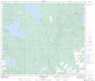
Maps showing Pullar Lake, 15-65-10-W4, Alberta
Pullar Lake is a Lake located in 15-65-10-W4, Alberta.
- Latitude: 54° 37' 25'' North (decimal: 54.6236109)
- Longitude: 111° 25' 52'' West (decimal: -111.4311110)
- Topography Feature Category: Lake
- Geographical Feature: Lake
- Canadian Province/Territory: Alberta
- Location: 15-65-10-W4
- Atlas of Canada Locator Map: Pullar Lake
- GPS Coordinate Locator Map: Pullar Lake Lat/Long
Pullar Lake NTS Map Sheets