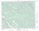
Maps showing Ram Falls Provincial Park, 9-18-36-13-5, Alberta
Ram Falls Provincial Park is a Conservation area located in 9-18-36-13-5, Alberta.
- Latitude: 52° 5' 49'' North (decimal: 52.0969000)
- Longitude: 115° 50' 21'' West (decimal: -115.8392000)
- Topography Feature Category: Conservation area
- Geographical Feature: Provincial Park
- Canadian Province/Territory: Alberta
- Location: 9-18-36-13-5
- Atlas of Canada Locator Map: Ram Falls Provincial Park
- GPS Coordinate Locator Map: Ram Falls Provincial Park Lat/Long
Ram Falls Provincial Park NTS Map Sheets