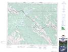
Maps showing Rock Lake Provincial Park, 16-9-52-2-6, Alberta
Rock Lake Provincial Park is a Conservation area located in 16-9-52-2-6, Alberta.
- Latitude: 53° 28' 59'' North (decimal: 53.4831000)
- Longitude: 118° 13' 35'' West (decimal: -118.2263999)
- Topography Feature Category: Conservation area
- Geographical Feature: Provincial Park
- Canadian Province/Territory: Alberta
- Location: 16-9-52-2-6
- Atlas of Canada Locator Map: Rock Lake Provincial Park
- GPS Coordinate Locator Map: Rock Lake Provincial Park Lat/Long
Rock Lake Provincial Park NTS Map Sheets