Maps showing Sheep River Provincial Park, 8-33-19-5-5, Alberta
Sheep River Provincial Park is a Conservation area located in 8-33-19-5-5, Alberta.
- Latitude: 50° 39' 7'' North (decimal: 50.6519000)
- Longitude: 114° 37' 27'' West (decimal: -114.6242000)
- Topography Feature Category: Conservation area
- Geographical Feature: Provincial Park
- Canadian Province/Territory: Alberta
- Location: 8-33-19-5-5
- Atlas of Canada Locator Map: Sheep River Provincial Park
- GPS Coordinate Locator Map: Sheep River Provincial Park Lat/Long
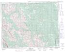
Sheep River Provincial Park NTS Map Sheets