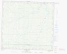
Maps showing Clear Hills County, 28-89-7-W6, Alberta
Clear Hills County is a Major municipal/district area - major agglomeration located in 28-89-7-W6, Alberta.
- Latitude: 56° 46' 10'' North (decimal: 56.7694444)
- Longitude: 119° 2' 14'' West (decimal: -119.0372222)
- Topography Feature Category: Major municipal/district area - major agglomeration
- Geographical Feature: Municipal County
- Canadian Province/Territory: Alberta
- Location: 28-89-7-W6
- Atlas of Canada Locator Map: Clear Hills County
- GPS Coordinate Locator Map: Clear Hills County Lat/Long
Clear Hills County NTS Map Sheets