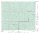
Maps showing Alexander 134a, Alberta
Alexander 134a is a Indian Reserve located in Alberta.
- Latitude: 54° 17' 3'' North (decimal: 54.2842008)
- Longitude: 116° 26' 55'' West (decimal: -116.4485591)
- Topography Feature Category: Indian Reserve
- Geographical Feature: Indian Reserve - Réserve indienne
- Canadian Province/Territory: Alberta
- Atlas of Canada Locator Map: Alexander 134a
- GPS Coordinate Locator Map: Alexander 134a Lat/Long
Alexander 134a NTS Map Sheets