Maps showing Alexander 134b, Alberta
Alexander 134b is a Indian Reserve located in Alberta.
- Latitude: 54° 20' 31'' North (decimal: 54.3420081)
- Longitude: 114° 48' 43'' West (decimal: -114.8120155)
- Topography Feature Category: Indian Reserve
- Geographical Feature: Indian Reserve - Réserve indienne
- Canadian Province/Territory: Alberta
- Atlas of Canada Locator Map: Alexander 134b
- GPS Coordinate Locator Map: Alexander 134b Lat/Long
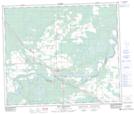
Alexander 134b NTS Map Sheets