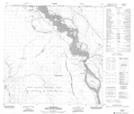
Maps showing Tthe Jere Ghaili 196b, Alberta
Tthe Jere Ghaili 196b is a Indian Reserve located in Alberta.
- Latitude: 59° 49' 8'' North (decimal: 59.8187881)
- Longitude: 111° 55' 42'' West (decimal: -111.9283958)
- Topography Feature Category: Indian Reserve
- Geographical Feature: Indian Reserve - Réserve indienne
- Canadian Province/Territory: Alberta
- Atlas of Canada Locator Map: Tthe Jere Ghaili 196b
- GPS Coordinate Locator Map: Tthe Jere Ghaili 196b Lat/Long
Tthe Jere Ghaili 196b NTS Map Sheets