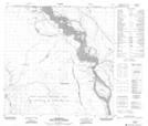
Maps showing Li Dezé 196c, Alberta
Li Dezé 196c is a Indian Reserve located in Alberta.
- Latitude: 59° 52' 8'' North (decimal: 59.8688479)
- Longitude: 111° 33' 13'' West (decimal: -111.5536806)
- Topography Feature Category: Indian Reserve
- Geographical Feature: Indian Reserve - Réserve indienne
- Canadian Province/Territory: Alberta
- Atlas of Canada Locator Map: Li Dezé 196c
- GPS Coordinate Locator Map: Li Dezé 196c Lat/Long
Li Dezé 196c NTS Map Sheets