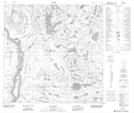
Maps showing Hokedhe Túe 196e, Alberta
Hokedhe Túe 196e is a Indian Reserve located in Alberta.
- Latitude: 59° 40' 53'' North (decimal: 59.6813771)
- Longitude: 111° 17' 39'' West (decimal: -111.2941509)
- Topography Feature Category: Indian Reserve
- Geographical Feature: Indian Reserve - Réserve indienne
- Canadian Province/Territory: Alberta
- Atlas of Canada Locator Map: Hokedhe Túe 196e
- GPS Coordinate Locator Map: Hokedhe Túe 196e Lat/Long
Hokedhe Túe 196e NTS Map Sheets