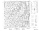
Maps showing Tsu Túe 196g, Alberta
Tsu Túe 196g is a Indian Reserve located in Alberta.
- Latitude: 59° 56' 58'' North (decimal: 59.9494765)
- Longitude: 110° 33' 45'' West (decimal: -110.5625371)
- Topography Feature Category: Indian Reserve
- Geographical Feature: Indian Reserve - Réserve indienne
- Canadian Province/Territory: Alberta
- Atlas of Canada Locator Map: Tsu Túe 196g
- GPS Coordinate Locator Map: Tsu Túe 196g Lat/Long
Tsu Túe 196g NTS Map Sheets