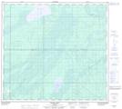
Maps showing Fort Mckay 174c, Alberta
Fort Mckay 174c is a Indian Reserve located in Alberta.
- Latitude: 57° 21' 00'' North (decimal: 57.3499551)
- Longitude: 111° 23' 5'' West (decimal: -111.3846175)
- Topography Feature Category: Indian Reserve
- Geographical Feature: Indian Reserve - Réserve indienne
- Canadian Province/Territory: Alberta
- Atlas of Canada Locator Map: Fort Mckay 174c
- GPS Coordinate Locator Map: Fort Mckay 174c Lat/Long
Fort Mckay 174c NTS Map Sheets