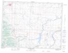
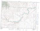
Maps showing Piikani 147, 33,8,27, Alberta
Piikani 147 is a Indian Reserve located in 33,8,27, Alberta.
- Latitude: 49° 35' 27'' North (decimal: 49.5908331)
- Longitude: 113° 39' 47'' West (decimal: -113.6630553)
- Topography Feature Category: Indian Reserve
- Geographical Feature: Indian Reserve - Réserve indienne
- Canadian Province/Territory: Alberta
- Location: 33,8,27
- Atlas of Canada Locator Map: Piikani 147
- GPS Coordinate Locator Map: Piikani 147 Lat/Long
Piikani 147 NTS Map Sheets