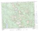
Maps showing Mount Abel, Rupert Land District, British Columbia
Mount Abel is a Mountain located in Rupert Land District, British Columbia.
- Latitude: 50° 12' 44'' North (decimal: 50.2122222)
- Longitude: 126° 19' 14'' West (decimal: -126.320556)
- Topography Feature Category: Mountain
- Geographical Feature: Mount
- Canadian Province/Territory: British Columbia
- Location: Rupert Land District
- Atlas of Canada Locator Map: Mount Abel
- GPS Coordinate Locator Map: Mount Abel Lat/Long
Mount Abel NTS Map Sheets