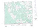
Maps showing Akamina Ridge, Kootenay Land District, British Columbia
Akamina Ridge is a Mountain located in Kootenay Land District, British Columbia and has an elevation of 2217 meters.
- Latitude: 49° 0' 34'' North (decimal: 49.0094444)
- Longitude: 114° 6' 25'' West (decimal: -114.1069444)
- Topography Feature Category: Mountain
- Geographical Feature: Ridge
- Canadian Province/Territory: British Columbia
- Elevation: 2217 meters
- Location: Kootenay Land District
- Atlas of Canada Locator Map: Akamina Ridge
- GPS Coordinate Locator Map: Akamina Ridge Lat/Long