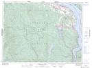
Maps showing Eagle Heights, Helmcken Land District, British Columbia
Eagle Heights is a Mountain located in Helmcken Land District, British Columbia and has an elevation of 790 meters.
- Latitude: 48° 40' 20'' North (decimal: 48.6722222)
- Longitude: 123° 46' 37'' West (decimal: -123.7769444)
- Topography Feature Category: Mountain
- Geographical Feature: Hills
- Canadian Province/Territory: British Columbia
- Elevation: 790 meters
- Location: Helmcken Land District
- Atlas of Canada Locator Map: Eagle Heights
- GPS Coordinate Locator Map: Eagle Heights Lat/Long
Eagle Heights NTS Map Sheets