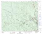
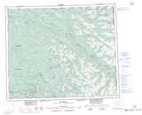
Maps showing Eaglenest Mountain, Cariboo Land District, British Columbia
Eaglenest Mountain is a Mountain located in Cariboo Land District, British Columbia and has an elevation of 1636 meters.
- Latitude: 53° 5' 28'' North (decimal: 53.0911111)
- Longitude: 121° 46' 38'' West (decimal: -121.777222)
- Topography Feature Category: Mountain
- Geographical Feature: Mountain
- Canadian Province/Territory: British Columbia
- Elevation: 1636 meters
- Location: Cariboo Land District
- Atlas of Canada Locator Map: Eaglenest Mountain
- GPS Coordinate Locator Map: Eaglenest Mountain Lat/Long