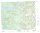
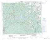
Maps showing Eagles Nest Peak, Kamloops Division Yale Land District, British Columbia
Eagles Nest Peak is a Mountain located in Kamloops Division Yale Land District, British Columbia and has an elevation of 1937 meters.
- Latitude: 52° 27' 28'' North (decimal: 52.4577778)
- Longitude: 120° 31' 31'' West (decimal: -120.525278)
- Topography Feature Category: Mountain
- Geographical Feature: Peak
- Canadian Province/Territory: British Columbia
- Elevation: 1937 meters
- Location: Kamloops Division Yale Land District
- Atlas of Canada Locator Map: Eagles Nest Peak
- GPS Coordinate Locator Map: Eagles Nest Peak Lat/Long
Eagles Nest Peak NTS Map Sheets