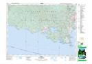
Maps showing Broom Hill, Sooke Land District, British Columbia
Broom Hill is a Mountain located in Sooke Land District, British Columbia and has an elevation of 176 meters.
- Latitude: 48° 23' 9'' North (decimal: 48.3858333)
- Longitude: 123° 45' 34'' West (decimal: -123.7594444)
- Topography Feature Category: Mountain
- Geographical Feature: Hill
- Canadian Province/Territory: British Columbia
- Elevation: 176 meters
- Location: Sooke Land District
- Atlas of Canada Locator Map: Broom Hill
- GPS Coordinate Locator Map: Broom Hill Lat/Long