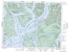
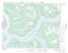
Maps showing East Redonda Island, New Westminster Land District, British Columbia
East Redonda Island is a Island located in New Westminster Land District, British Columbia and has an elevation of 512 meters.
- Latitude: 50° 14' 32'' North (decimal: 50.2422222)
- Longitude: 124° 42' 38'' West (decimal: -124.710556)
- Topography Feature Category: Island
- Geographical Feature: Island
- Canadian Province/Territory: British Columbia
- Elevation: 512 meters
- Location: New Westminster Land District
- Atlas of Canada Locator Map: East Redonda Island
- GPS Coordinate Locator Map: East Redonda Island Lat/Long
East Redonda Island NTS Map Sheets