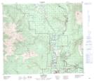
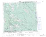
Maps showing Glen Vowell, Cassiar Land District, British Columbia
Glen Vowell is a Unincorporated area located in Cassiar Land District, British Columbia and has an elevation of 247 meters.
- Latitude: 55° 18' 44'' North (decimal: 55.3122222)
- Longitude: 127° 40' 24'' West (decimal: -127.673333)
- Topography Feature Category: Unincorporated area
- Geographical Feature: Community
- Canadian Province/Territory: British Columbia
- Elevation: 247 meters
- Location: Cassiar Land District
- Atlas of Canada Locator Map: Glen Vowell
- GPS Coordinate Locator Map: Glen Vowell Lat/Long