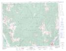
Maps showing Bull Mountain, Kootenay Land District, British Columbia
Bull Mountain is a Mountain located in Kootenay Land District, British Columbia.
- Latitude: 49° 32' 1'' North (decimal: 49.5336111)
- Longitude: 115° 24' 41'' West (decimal: -115.4113888)
- Topography Feature Category: Mountain
- Geographical Feature: Mountain
- Canadian Province/Territory: British Columbia
- Location: Kootenay Land District
- Atlas of Canada Locator Map: Bull Mountain
- GPS Coordinate Locator Map: Bull Mountain Lat/Long