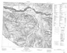
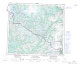
Maps showing Mount Claude, Cassiar Land District, British Columbia
Mount Claude is a Mountain located in Cassiar Land District, British Columbia and has an elevation of 1636 meters.
- Latitude: 56° 37' 32'' North (decimal: 56.6255555)
- Longitude: 131° 21' 48'' West (decimal: -131.3633333)
- Topography Feature Category: Mountain
- Geographical Feature: Mount
- Canadian Province/Territory: British Columbia
- Elevation: 1636 meters
- Location: Cassiar Land District
- Atlas of Canada Locator Map: Mount Claude
- GPS Coordinate Locator Map: Mount Claude Lat/Long
Mount Claude NTS Map Sheets